National Key Institutions and Industrial Bases
Key Areas for Disaster Prevention, Mitigation, and Control
Large Transportation Hubs
Large Energy Bases
Integrating defense subsystems including counter-UAS, ground surveillance, counter-space, surface/underwater surveillance, and environmental monitoring, the project established an intelligent defense system covering land, sea, and air, enabling uninterrupted, all-weather protection.
By integrating multidimensional sensing equipment, including electronic fences, radar, electro-optical systems, unmanned aerial vehicles, unmanned ground vehicles, and robotic dogs, the project created an integrated “air–space–ground” monitoring network, enabling unmanned 24/7 security operations and intelligent emergency response.
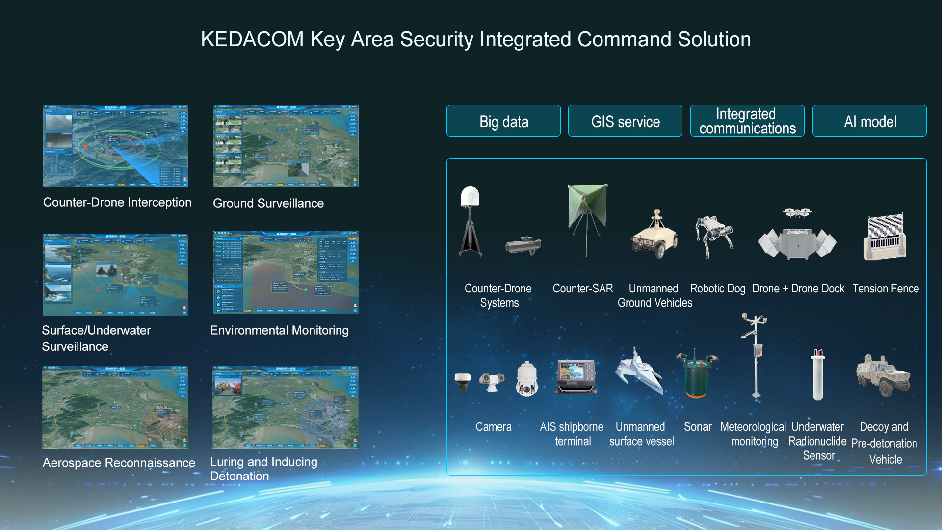
Relying on radar, spectrum, electro-optical, and other multi-source sensing equipment, we establish a three-level airspace warning perimeter to capture and identify drone targets in real time, automatically issue alerts by threat level, intelligently match the optimal response plan, and deploy navigation spoofing and countermeasure equipment for precision strikes, effectively addressing low-altitude threats.
Unmanned inspections are conducted using drones, unmanned ground vehicles, and robotic dogs. Combined with AI cameras and AR high-point monitoring, the system precisely identifies intrusions, fires, and personnel anomalies. After an alarm is triggered, it coordinates unmanned equipment to conduct close-range reconnaissance, forward interception, and deterrence using powerful sound, while simultaneously coordinating emergency response, firefighting, and security forces at key sites for joint handling, enabling operations to be conducted on a shared map.
Optical and SAR satellite interference equipment is used to monitor the movements of passing satellites in real time, precisely identify and issue alerts for illegal space reconnaissance activities originating from abroad. In key protected areas and during important exercises, satellite defense missions can be preset to enable automatic directional interference, while on-duty personnel are dispatched simultaneously for on-site coordinated control.
For the protection of key targets, a decoy-and-intercept vehicle serves as the mobile core, integrating payloads such as infrared and laser detection systems, as well as an integrated radio reconnaissance, interference, and deception system. Once an incoming drone is detected, laser suppression or decoy diversion and detonation is carried out, while ground forces are coordinated to neutralize the threat.
Radar and AIS are used to monitor unauthorized vessels in real time. Once an alarm is triggered, drones and unmanned surface vessels are coordinated to broadcast warnings and drive them away. Underwater sonar and robots are used to intelligently detect abnormal underwater targets, filling the gap in underwater security left by conventional shore-based monitoring and establishing a three-dimensional surface/underwater defense network.
Relying on ground- and underwater environmental monitoring equipment alongside unmanned vessel inspections, the system collects real-time data on nuclear radiation, toxic pollutants, and weather conditions around key sites, automatically issuing alerts when levels exceed thresholds. The command center can dispatch unmanned vessels to trace and verify sources, deploy emergency response and environmental protection personnel for on-site control, and simultaneously optimize mitigation strategies.
 globalsupport@kedacom.com